
Fällanden topographic map
Interactive map
Click on the map to display elevation.
About this map
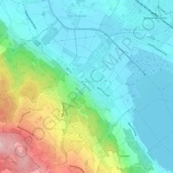
Name: Fällanden topographic map, elevation, terrain.
Location: Fällanden, Bezirk Uster, Zurich, 8117, Switzerland (47.35707 8.61470 47.38347 8.66456)
Average elevation: 499 m
Minimum elevation: 431 m
Maximum elevation: 688 m