
Luther topographic map
Interactive map
Click on the map to display elevation.
About this map
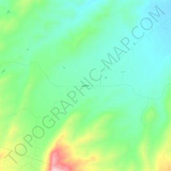
Name: Luther topographic map, elevation, terrain.
Location: Luther, Carbon County, Montana, United States (45.26439 -109.44877 45.30439 -109.40877)
Average elevation: 1,604 m
Minimum elevation: 1,525 m
Maximum elevation: 1,798 m
Other topographic maps
Click on a map to view its topography, its elevation and its terrain.
Boyd
United States > Montana > Carbon County
Boyd, Carbon County, Montana, 59013, United States
Average elevation: 1,239 m
Red Lodge
United States > Montana > Carbon County
Red Lodge, Carbon County, Montana, 59068, United States
Average elevation: 1,720 m
Joliet
United States > Montana > Carbon County
Joliet, Carbon County, Montana, 59041, United States
Average elevation: 1,162 m