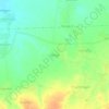
Batang topographic map
Click on the map to display elevation.
About this map

Name: Batang topographic map, elevation, terrain.
Location: Batang, Central Java, Indonesia (-7.19639 109.67329 -6.86822 110.05347)
Average elevation: 557 m
Minimum elevation: 0 m
Maximum elevation: 2,580 m
Other topographic maps
Click on a map to view its topography, its elevation and its terrain.


Kawah Sikidang
Indonesia > Central Java > Banjarnegara > Dieng Kulon > Karang Sari
Average elevation: 2,100 m


Perempatan Sibedug Kajen Titik 0 Km
Indonesia > Central Java > Pekalongan > Kajen
Average elevation: 34 m