
Thank you for supporting this site ❤️
Make a donation
Make a donation
Esatpaşa Mahallesi topographic map
Click on the map to display elevation.
Thank you for supporting this site ❤️
Make a donation
Make a donation
About this map
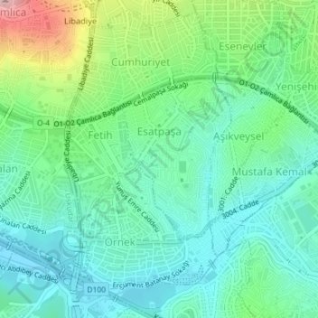
Name: Esatpaşa Mahallesi topographic map, elevation, terrain.
Location: Esatpaşa Mahallesi, Ataşehir, Istanbul, Marmara Region, Turkey (40.99564 29.07855 41.00949 29.09096)
Average elevation: 67 m
Minimum elevation: 11 m
Maximum elevation: 218 m
Thank you for supporting this site ❤️
Make a donation
Make a donation