
沙河口区 topographic map
Interactive map
Click on the map to display elevation.
About this map
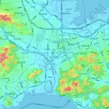
Name: 沙河口区 topographic map, elevation, terrain.
Location: 沙河口区, 大连市, Liaoning, 116000, Cina (38.86366 121.52840 38.94789 121.60574)
Average elevation: 40 m
Minimum elevation: -3 m
Maximum elevation: 264 m
Other topographic maps
Click on a map to view its topography, its elevation and its terrain.