
潭西镇 topographic map
Interactive map
Click on the map to display elevation.
About this map
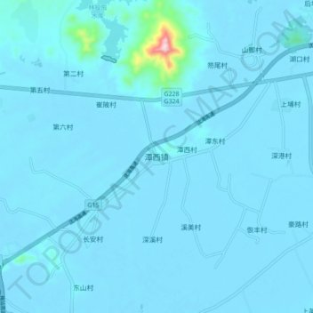
Name: 潭西镇 topographic map, elevation, terrain.
Location: 潭西镇, 陆丰市, 汕尾市, 广东省, 中国 (22.89514 115.50811 22.97514 115.58811)
Average elevation: 13 m
Minimum elevation: -4 m
Maximum elevation: 380 m
Other topographic maps
Click on a map to view its topography, its elevation and its terrain.