
Rapa topographic map
Interactive map
Click on the map to display elevation.
About this map
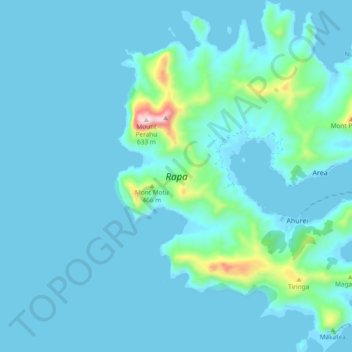
Name: Rapa topographic map, elevation, terrain.
Location: Rapa, Îles Australes, Polynésie française, France (-27.64998 -144.38136 -27.56647 -144.30470)
Average elevation: 53 m
Minimum elevation: -4 m
Maximum elevation: 573 m