
Western Province topographic map
Interactive map
Click on the map to display elevation.
About this map
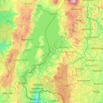
Name: Western Province topographic map, elevation, terrain.
Location: Western Province, Rwanda (-2.74340 28.86175 -1.50616 29.67519)
Average elevation: 1,857 m
Minimum elevation: 929 m
Maximum elevation: 4,358 m
Other topographic maps
Click on a map to view its topography, its elevation and its terrain.