
Bernbeuren topographic map
Interactive map
Click on the map to display elevation.
About this map
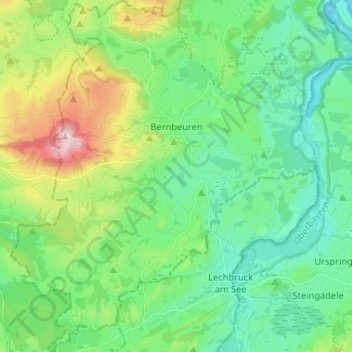
Name: Bernbeuren topographic map, elevation, terrain.
Average elevation: 789 m
Minimum elevation: 694 m
Maximum elevation: 1,047 m
Other topographic maps
Click on a map to view its topography, its elevation and its terrain.
Fischen
Deutschland > Bayern > Landkreis Weilheim-Schongau
Fischen, Pähl, Landkreis Weilheim-Schongau, Bayern, 82396, Deutschland
Average elevation: 577 m