
Thank you for supporting this site ❤️
Make a donation
Make a donation
Chatsworth topographic map
Click on the map to display elevation.
Thank you for supporting this site ❤️
Make a donation
Make a donation
About this map
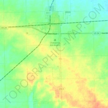
Name: Chatsworth topographic map, elevation, terrain.
Location: Chatsworth, Livingston County, Illinois, United States (40.69911 -88.31476 40.76874 -88.27479)
Average elevation: 229 m
Minimum elevation: 210 m
Maximum elevation: 251 m
Thank you for supporting this site ❤️
Make a donation
Make a donation
Other topographic maps
Click on a map to view its topography, its elevation and its terrain.