
Thank you for supporting this site ❤️
Make a donation
Make a donation
Linkhout topographic map
Click on the map to display elevation.
Thank you for supporting this site ❤️
Make a donation
Make a donation
About this map
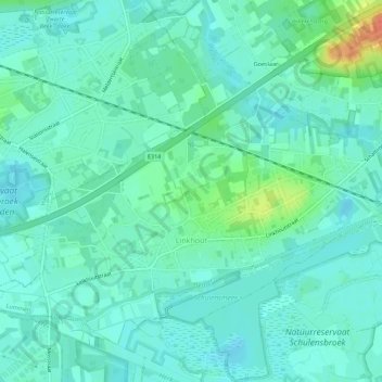
Name: Linkhout topographic map, elevation, terrain.
Location: Linkhout, Lummen, Hasselt, Limbourg, Flandre, Belgique (50.95612 5.10846 50.98450 5.16423)
Average elevation: 24 m
Minimum elevation: 13 m
Maximum elevation: 61 m
Thank you for supporting this site ❤️
Make a donation
Make a donation