
Kağıthane topographic map
Interactive map
Click on the map to display elevation.
About this map
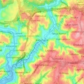
Name: Kağıthane topographic map, elevation, terrain.
Location: Kağıthane, Istanbul, Marmara Region, Turkey (41.05296 28.94808 41.10823 29.00832)
Average elevation: 67 m
Minimum elevation: -1 m
Maximum elevation: 137 m
Other topographic maps
Click on a map to view its topography, its elevation and its terrain.
Hürriyet Mahallesi
Hürriyet Mahallesi, Kağıthane, Istanbul, Marmara Region, Turkey
Average elevation: 80 m