
Thank you for supporting this site ❤️
Make a donation
Make a donation
Taypiplaya topographic map
Click on the map to display elevation.
Thank you for supporting this site ❤️
Make a donation
Make a donation
About this map
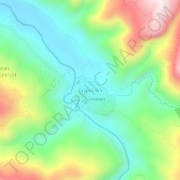
Name: Taypiplaya topographic map, elevation, terrain.
Location: Taypiplaya, Caranavi, La Paz, Bolivia (-15.95854 -67.49655 -15.91854 -67.45655)
Average elevation: 1,009 m
Minimum elevation: 753 m
Maximum elevation: 1,494 m
Thank you for supporting this site ❤️
Make a donation
Make a donation
Other topographic maps
Click on a map to view its topography, its elevation and its terrain.