
Demmelsdorf topographic map
Interactive map
Click on the map to display elevation.
Demmelsdorf
Das Dorf hatte bis zur Zeit des Nationalsozialismus eine starke jüdische Bevölkerung. Auf einer Anhöhe über Demmelsdorf befindet sich noch ein gut erhaltener Judenfriedhof.
About this map
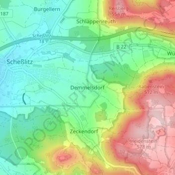
Name: Demmelsdorf topographic map, elevation, terrain.
Average elevation: 398 m
Minimum elevation: 294 m
Maximum elevation: 575 m