
Reșița topographic map
Interactive map
Click on the map to display elevation.
About this map
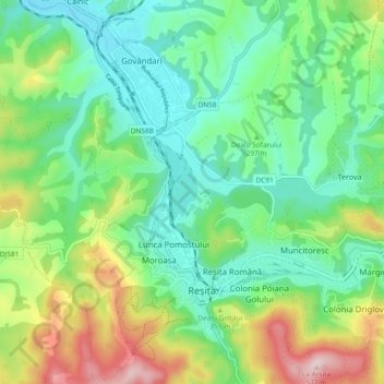
Name: Reșița topographic map, elevation, terrain.
Location: Reșița, Caraș-Severin, Romania (45.27843 21.85963 45.33296 21.95315)
Average elevation: 307 m
Minimum elevation: 193 m
Maximum elevation: 559 m