
Tanjung Harapan topographic map
Interactive map
Click on the map to display elevation.
About this map
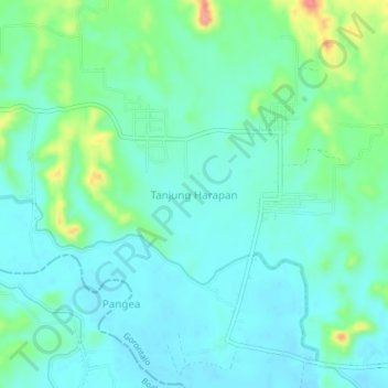
Name: Tanjung Harapan topographic map, elevation, terrain.
Location: Tanjung Harapan, Gorontalo, Indonesia (0.74463 122.45879 0.78463 122.49879)
Average elevation: 58 m
Minimum elevation: 35 m
Maximum elevation: 134 m