
Barrytown topographic map
Interactive map
Click on the map to display elevation.
About this map
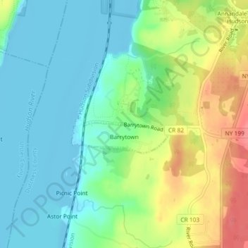
Name: Barrytown topographic map, elevation, terrain.
Average elevation: 26 m
Minimum elevation: -6 m
Maximum elevation: 78 m
Other topographic maps
Click on a map to view its topography, its elevation and its terrain.
Annandale-on-Hudson
United States > New York > Dutchess County > Town of Red Hook
Annandale-on-Hudson, Town of Red Hook, Dutchess County, New York, 12504, United States
Average elevation: 43 m
Cokertown
United States > New York > Dutchess County > Town of Red Hook
Cokertown, Town of Red Hook, Dutchess County, New York, 12571, United States
Average elevation: 106 m