
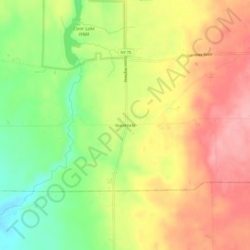
Marshfield topographic map
Interactive map
Click on the map to display elevation.
About this map
Name: Marshfield topographic map, elevation, terrain.
Average elevation: 398 m
Minimum elevation: 329 m
Maximum elevation: 457 m
Other topographic maps
Click on a map to view its topography, its elevation and its terrain.
Langford
United States > New York > Erie County > Town of North Collins
Langford, Town of North Collins, Erie County, New York, United States
Average elevation: 389 m
New Oregon
United States > New York > Erie County > Town of North Collins
New Oregon, Town of North Collins, Erie County, New York, United States
Average elevation: 390 m
Shirley
United States > New York > Erie County > Town of North Collins
Shirley, Town of North Collins, Erie County, New York, 14111, United States
Average elevation: 322 m
Lawtons
United States > New York > Erie County > Town of North Collins
Lawtons, Town of North Collins, Erie County, New York, 14091, United States
Average elevation: 270 m