
Goltry topographic map
Interactive map
Click on the map to display elevation.
About this map
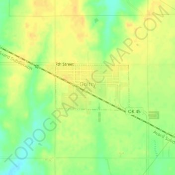
Name: Goltry topographic map, elevation, terrain.
Location: Goltry, Alfalfa County, Oklahoma, 73739, United States (36.52845 -98.15793 36.53547 -98.14377)
Average elevation: 419 m
Minimum elevation: 402 m
Maximum elevation: 429 m
Other topographic maps
Click on a map to view its topography, its elevation and its terrain.
Helena
United States > Oklahoma > Alfalfa County
Helena, Alfalfa County, Oklahoma, 73741, United States
Average elevation: 428 m
Carmen
United States > Oklahoma > Alfalfa County
Carmen, Alfalfa County, Oklahoma, 73726, United States
Average elevation: 411 m
Aline
United States > Oklahoma > Alfalfa County
Aline, Alfalfa County, Oklahoma, United States
Average elevation: 397 m
Jet
United States > Oklahoma > Alfalfa County
Jet, Alfalfa County, Oklahoma, 73749, United States
Average elevation: 378 m