
Thank you for supporting this site ❤️
Make a donation
Make a donation
Linge topographic map
Click on the map to display elevation.
Thank you for supporting this site ❤️
Make a donation
Make a donation
About this map
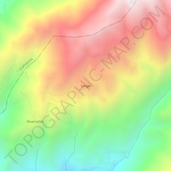
Name: Linge topographic map, elevation, terrain.
Location: Linge, Huigra, Alausí, Chimborazo, Ecuador (-2.29084 -79.06018 -2.25084 -79.02018)
Average elevation: 1,857 m
Minimum elevation: 1,129 m
Maximum elevation: 2,612 m
Thank you for supporting this site ❤️
Make a donation
Make a donation