
Selok Anyar topographic map
Interactive map
Click on the map to display elevation.
About this map
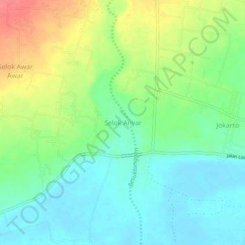
Name: Selok Anyar topographic map, elevation, terrain.
Location: Selok Anyar, Lumajang, East Java, Java, Indonesia (-8.28005 113.15295 -8.24005 113.19295)
Average elevation: 26 m
Minimum elevation: 2 m
Maximum elevation: 68 m
Other topographic maps
Click on a map to view its topography, its elevation and its terrain.
Selok Awar Awar
Indonesia > East Java > Lumajang
Selok Awar Awar, Lumajang, East Java, Java, Indonesia
Average elevation: 48 m
Mount Semeru
Indonesia > East Java > Lumajang
Mount Semeru, Lumajang, East Java, Indonesia
Average elevation: 3,103 m