
Surabaya topographic map
Interactive map
Click on the map to display elevation.
About this map
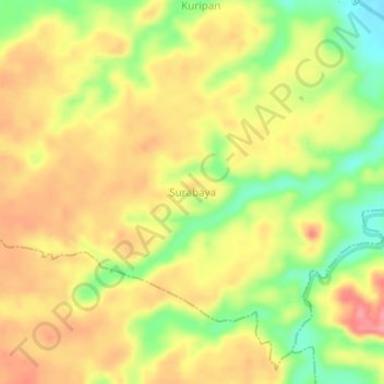
Name: Surabaya topographic map, elevation, terrain.
Average elevation: 192 m
Minimum elevation: 138 m
Maximum elevation: 233 m
Other topographic maps
Click on a map to view its topography, its elevation and its terrain.
Pulau Kemiling
Indonesia > South Sumatra > Ogan Komering Ulu Selatan
Pulau Kemiling, Runjung Agung, Ogan Komering Ulu Selatan, South Sumatra, Indonesia
Average elevation: 431 m