
Newcastle topographic map
Interactive map
Click on the map to display elevation.
About this map
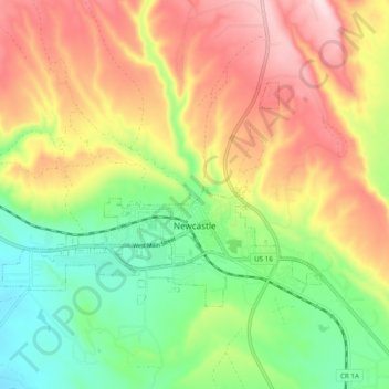
Name: Newcastle topographic map, elevation, terrain.
Location: Newcastle, Weston County, Wyoming, 82715, United States (43.84015 -104.26995 43.88062 -104.17248)
Average elevation: 1,389 m
Minimum elevation: 1,249 m
Maximum elevation: 1,554 m
Other topographic maps
Click on a map to view its topography, its elevation and its terrain.
Four Corners
United States > Wyoming > Weston County
Four Corners, Weston County, Wyoming, United States
Average elevation: 1,792 m