
Thank you for supporting this site ❤️
Make a donation
Make a donation
Guangrao County topographic map
Click on the map to display elevation.
Thank you for supporting this site ❤️
Make a donation
Make a donation
About this map
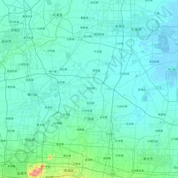
Name: Guangrao County topographic map, elevation, terrain.
Location: Guangrao County, Dongying, Shandong, 257100, China (36.93599 118.28133 37.41557 119.24320)
Average elevation: 13 m
Minimum elevation: -3 m
Maximum elevation: 210 m
Thank you for supporting this site ❤️
Make a donation
Make a donation
Other topographic maps
Click on a map to view its topography, its elevation and its terrain.