
Thank you for supporting this site ❤️
Make a donation
Make a donation
Mayo topographic map
Click on the map to display elevation.
Thank you for supporting this site ❤️
Make a donation
Make a donation
About this map
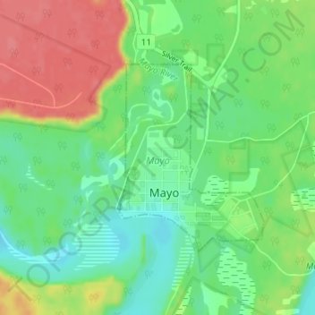
Name: Mayo topographic map, elevation, terrain.
Location: Mayo, Yukon, Canada (63.58759 -135.90479 63.60370 -135.87695)
Average elevation: 499 m
Minimum elevation: 474 m
Maximum elevation: 537 m
Thank you for supporting this site ❤️
Make a donation
Make a donation