
Thank you for supporting this site ❤️
Make a donation
Make a donation
Tollgate topographic map
Click on the map to display elevation.
Thank you for supporting this site ❤️
Make a donation
Make a donation
About this map
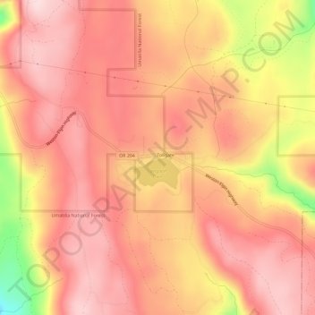
Name: Tollgate topographic map, elevation, terrain.
Location: Tollgate, Umatilla County, Oregon, United States (45.76077 -118.11131 45.80077 -118.07131)
Average elevation: 1,512 m
Minimum elevation: 1,303 m
Maximum elevation: 1,591 m
Thank you for supporting this site ❤️
Make a donation
Make a donation
Other topographic maps
Click on a map to view its topography, its elevation and its terrain.
Thank you for supporting this site ❤️
Make a donation
Make a donation
Thank you for supporting this site ❤️
Make a donation
Make a donation
Thank you for supporting this site ❤️
Make a donation
Make a donation