
The Herring Pools (Low tide only) topographic map
Interactive map
Click on the map to display elevation.
About this map
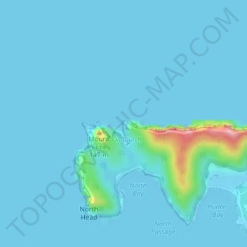
Name: The Herring Pools (Low tide only) topographic map, elevation, terrain.
Average elevation: 12 m
Minimum elevation: -1 m
Maximum elevation: 178 m
Other topographic maps
Click on a map to view its topography, its elevation and its terrain.
Lord Howe Island
Australia > New South Wales > Lord Howe Island
Lord Howe Island, New South Wales, 2898, Australia
Average elevation: 27 m
Mount Gower
Australia > New South Wales > Lord Howe Island
Mount Gower, Lord Howe Island, New South Wales, 2898, Australia
Average elevation: 120 m