Geolocate

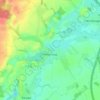
Fischbek topographic map

Click on the map to display elevation.

About this map

Name: Fischbek topographic map, elevation, terrain.

Location: Fischbek, Elmenhorst, Bargteheide-Land, Kreis Stormarn, Schleswig-Holstein, 23869, Germany (53.74413 10.26659 53.78413 10.30659)

Average elevation: 37 m

Minimum elevation: 9 m

Maximum elevation: 62 m

Other topographic maps

Click on a map to view its topography, its elevation and its terrain.

Ammersbek

Germany > Schleswig-Holstein > Kreis Stormarn

Average elevation: 36 m

Heilshoop

Germany > Schleswig-Holstein > Kreis Stormarn

Average elevation: 28 m

Glinde

Germany > Schleswig-Holstein > Kreis Stormarn

Average elevation: 33 m