
La Roche topographic map
Interactive map
Click on the map to display elevation.
About this map
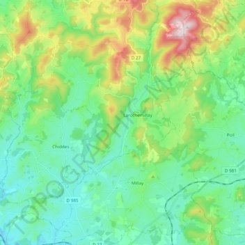
Name: La Roche topographic map, elevation, terrain.
Average elevation: 397 m
Minimum elevation: 244 m
Maximum elevation: 821 m
Other topographic maps
Click on a map to view its topography, its elevation and its terrain.
Larochemillay
Frankrijk > Bourgondië-Franche-Comté > Nièvre > Larochemillay
Larochemillay, Château-Chinon (Ville), Nièvre, Bourgondië-Franche-Comté, Metropolitaans Frankrijk, 58370, Frankrijk
Average elevation: 425 m