
Ponte Taro topographic map
Interactive map
Click on the map to display elevation.
About this map
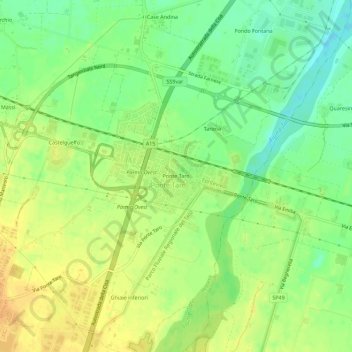
Name: Ponte Taro topographic map, elevation, terrain.
Location: Ponte Taro, Fontevivo, Parma, Emilia-Romagna, 43010, Italia (44.80509 10.19332 44.84509 10.23332)
Average elevation: 61 m
Minimum elevation: 43 m
Maximum elevation: 76 m
Other topographic maps
Click on a map to view its topography, its elevation and its terrain.
Bianconese
Italia > Emilia-Romagna > Parma > Fontevivo
Bianconese, Fontevivo, Parma, Emilia-Romagna, 43010, Italia
Average elevation: 52 m