
Casomera topographic map
Interactive map
Click on the map to display elevation.
About this map
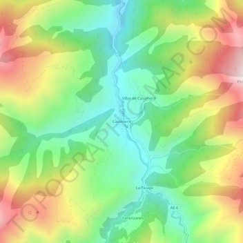
Name: Casomera topographic map, elevation, terrain.
Location: Casomera, Aller, Asturias, 33681, España (43.06117 -5.59726 43.10117 -5.55726)
Average elevation: 946 m
Minimum elevation: 570 m
Maximum elevation: 1,504 m
Other topographic maps
Click on a map to view its topography, its elevation and its terrain.
Rio Llananzanes
Rio Llananzanes, Aller, Asturias, 33681, España
Average elevation: 1,096 m
Pico los Aberrugues
Pico los Aberrugues, Aller, Asturias, 33688, España
Average elevation: 1,248 m