
Hoeleden topographic map
Interactive map
Click on the map to display elevation.
About this map
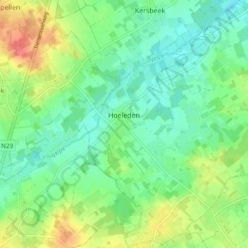
Name: Hoeleden topographic map, elevation, terrain.
Location: Hoeleden, Kortenaken, Louvain, Brabant flamand, 3471, Belgique (50.84556 4.97528 50.88797 5.03198)
Average elevation: 46 m
Minimum elevation: 26 m
Maximum elevation: 81 m