
Thank you for supporting this site ❤️
Make a donation
Make a donation
Tangkak topographic map
Click on the map to display elevation.
Thank you for supporting this site ❤️
Make a donation
Make a donation
About this map
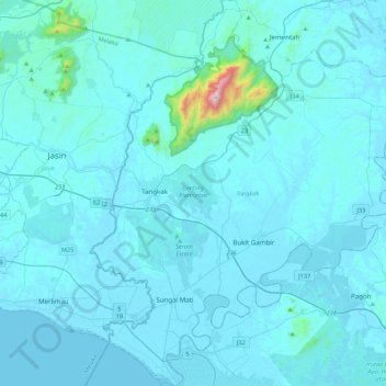
Name: Tangkak topographic map, elevation, terrain.
Location: Tangkak, Johor, Malaysia (2.04856 102.46729 2.48108 102.83157)
Average elevation: 48 m
Minimum elevation: 0 m
Maximum elevation: 1,214 m
Thank you for supporting this site ❤️
Make a donation
Make a donation
Other topographic maps
Click on a map to view its topography, its elevation and its terrain.