
Thank you for supporting this site ❤️
Make a donation
Make a donation
Mauran topographic map
Click on the map to display elevation.
Thank you for supporting this site ❤️
Make a donation
Make a donation
About this map
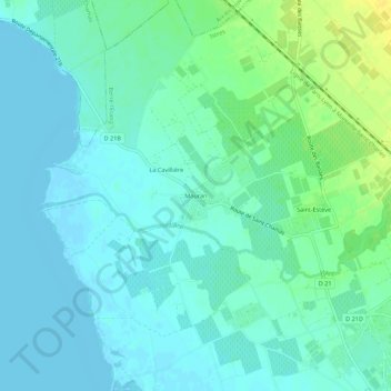
Name: Mauran topographic map, elevation, terrain.
Average elevation: 7 m
Minimum elevation: -2 m
Maximum elevation: 23 m
Thank you for supporting this site ❤️
Make a donation
Make a donation
Other topographic maps
Click on a map to view its topography, its elevation and its terrain.
Parc Maurin
France > Provence-Alpes-Côte d'Azur > Bouches-du-Rhône > Berre-l'Étang
Average elevation: 4 m