
武夷街道 topographic map
Interactive map
Click on the map to display elevation.
About this map
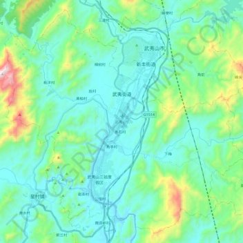
Name: 武夷街道 topographic map, elevation, terrain.
Location: 武夷街道, 武夷山市, 南平市, 福建省, 354300, 中国 (27.60672 117.88925 27.78995 118.11441)
Average elevation: 357 m
Minimum elevation: 169 m
Maximum elevation: 1,171 m
Other topographic maps
Click on a map to view its topography, its elevation and its terrain.
武夷山国家级风景名胜区
武夷山国家级风景名胜区, 武夷街道, 武夷山市, 南平市, 福建省, 354300, 中国
Average elevation: 302 m