
Isières topographic map
Interactive map
Click on the map to display elevation.
About this map
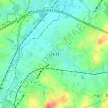
Name: Isières topographic map, elevation, terrain.
Location: Isières, Aat, Henegouwen, Wallonië, 7822, België (50.64380 3.79817 50.68380 3.83817)
Average elevation: 34 m
Minimum elevation: 19 m
Maximum elevation: 72 m