

Riyadh topographic map
Click on the map to display elevation.
Riyadh
It is the largest city on the Arabian Peninsula and is situated in the eastern part of the Najd plateau. The city sits at an average elevation of 600 meters (2,000 ft) above sea level, and receives around 5 million tourists each year, making it the forty-ninth most visited city in the world and the sixth in the Middle East. Riyadh had a population of 7 million people in 2022, making it the most populous city in Saudi Arabia, the fifth most populous in the Middle East, and the 38th most populous in Asia.
About this map
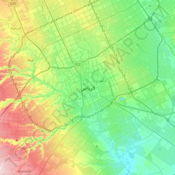
Name: Riyadh topographic map, elevation, terrain.
Location: Riyadh, Riyadh governorate, Riyadh Region, 12643, Saudi Arabia (24.47892 46.55601 24.79892 46.87601)
Average elevation: 630 m
Minimum elevation: 535 m
Maximum elevation: 835 m
Other topographic maps
Click on a map to view its topography, its elevation and its terrain.

Al Maathar Municipality
Saudi Arabia > Riyadh Region > Riyadh governorate > Riyadh
Average elevation: 636 m
