
Los Carriles topographic map
Interactive map
Click on the map to display elevation.
About this map
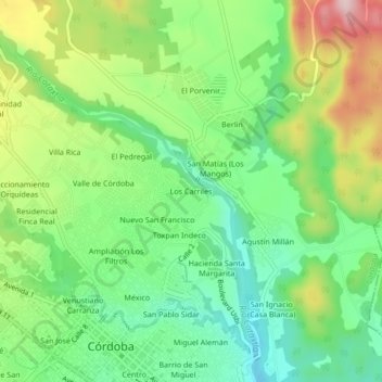
Name: Los Carriles topographic map, elevation, terrain.
Location: Los Carriles, Córdoba, Veracruz, 94500, Mexico (18.89070 -96.94642 18.93070 -96.90642)
Average elevation: 889 m
Minimum elevation: 780 m
Maximum elevation: 1,072 m