
Harbour Island topographic map
Interactive map
Click on the map to display elevation.
About this map
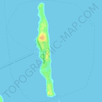
Name: Harbour Island topographic map, elevation, terrain.
Location: Harbour Island, The Bahamas (25.47359 -76.65554 25.52453 -76.60659)
Average elevation: 1 m
Minimum elevation: -1 m
Maximum elevation: 30 m
Other topographic maps
Click on a map to view its topography, its elevation and its terrain.