
Sri Purnama Beach topographic map
Interactive map
Click on the map to display elevation.
About this map
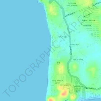
Name: Sri Purnama Beach topographic map, elevation, terrain.
Average elevation: 8 m
Minimum elevation: 0 m
Maximum elevation: 41 m
Other topographic maps
Click on a map to view its topography, its elevation and its terrain.
Batu 7.5
Malaysia > Negeri Sembilan > Port Dickson
Batu 7.5, Port Dickson, Negeri Sembilan, 71050, Malaysia
Average elevation: 8 m