
Woodbridge topographic map
Interactive map
Click on the map to display elevation.
About this map
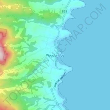
Name: Woodbridge topographic map, elevation, terrain.
Location: Woodbridge, Kingborough, Tasmania, Australia (-43.18350 147.18279 -43.13710 147.24930)
Average elevation: 70 m
Minimum elevation: -1 m
Maximum elevation: 479 m
Other topographic maps
Click on a map to view its topography, its elevation and its terrain.
Woodbridge Hill
Australia > Tasmania > Woodbridge
Woodbridge Hill, Woodbridge, Kingborough, Tasmania, 7162, Australia
Average elevation: 379 m
Woodbridge
Australia > Tasmania > Woodbridge
Woodbridge, Tasmania, 7155, Australia
Average elevation: 55 m