
Česká Lípa topographic map
Interactive map
Click on the map to display elevation.
About this map
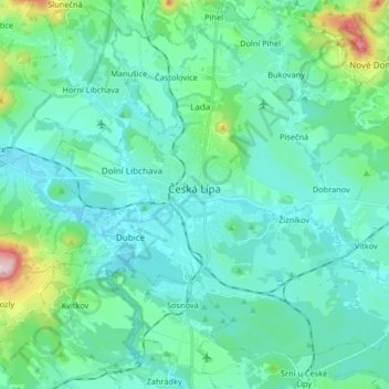
Name: Česká Lípa topographic map, elevation, terrain.
Average elevation: 291 m
Minimum elevation: 236 m
Maximum elevation: 584 m
Česká Lípa is located about 38 km (24 mi) west of Liberec and 67 km (42 mi) north of Prague. It lies in the Ralsko Uplands. The highest point is the Špičák hill with an altitude of 459 m (1,506 ft). The Ploučnice River flows through the town, approximately 40 km (25 mi) from its source. The southeastern part of the municipal territory extends into the Kokořínsko – Máchův kraj Protected Landscape Area.