
Clinton topographic map
Interactive map
Click on the map to display elevation.
About this map
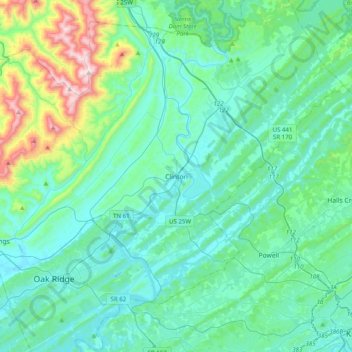
Name: Clinton topographic map, elevation, terrain.
Location: Clinton, Anderson County, Tennessee, 37716, United States (35.94341 -84.29186 36.26341 -83.97186)
Average elevation: 368 m
Minimum elevation: 231 m
Maximum elevation: 1,066 m