
Portelo topographic map
Interactive map
Click on the map to display elevation.
About this map
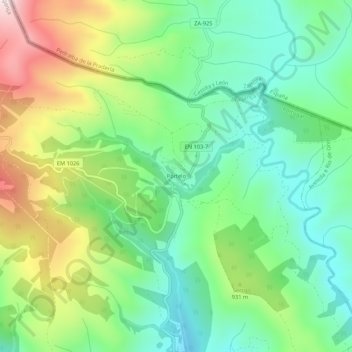
Name: Portelo topographic map, elevation, terrain.
Location: Portelo, França, Bragança, Distrito de Bragança, Portugal (41.90838 -6.74800 41.94838 -6.70800)
Average elevation: 869 m
Minimum elevation: 666 m
Maximum elevation: 1,254 m