
Thank you for supporting this site ❤️
Make a donation
Make a donation
San Pedro topographic map
Click on the map to display elevation.
Thank you for supporting this site ❤️
Make a donation
Make a donation
About this map
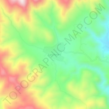
Name: San Pedro topographic map, elevation, terrain.
Location: San Pedro, Guanaceví, Durango, México (25.93683 -106.03927 25.97683 -105.99927)
Average elevation: 2,471 m
Minimum elevation: 2,205 m
Maximum elevation: 2,834 m
Thank you for supporting this site ❤️
Make a donation
Make a donation