
Tupambaé topographic map
Interactive map
Click on the map to display elevation.
About this map
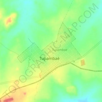
Name: Tupambaé topographic map, elevation, terrain.
Location: Tupambaé, Cerro Largo, 36100, Uruguay (-32.84196 -54.77349 -32.82684 -54.75300)
Average elevation: 293 m
Minimum elevation: 266 m
Maximum elevation: 330 m
Other topographic maps
Click on a map to view its topography, its elevation and its terrain.
Cerro de las Cuentas
Cerro de las Cuentas, Cerro Largo, 36200, Uruguay
Average elevation: 207 m
Plazoleta Gral. Artigas
Uruguay > Cerro Largo > Río Branco
Plazoleta Gral. Artigas, Olimar I, Río Branco, Cerro Largo, 37100, Uruguay
Average elevation: 11 m
Centurión
Uruguay > Cerro Largo > Centurión
Centurión, Cerro Largo, 37000, Uruguay
Average elevation: 149 m