
Thank you for supporting this site ❤️
Make a donation
Make a donation
El Llano topographic map
Click on the map to display elevation.
Thank you for supporting this site ❤️
Make a donation
Make a donation
About this map
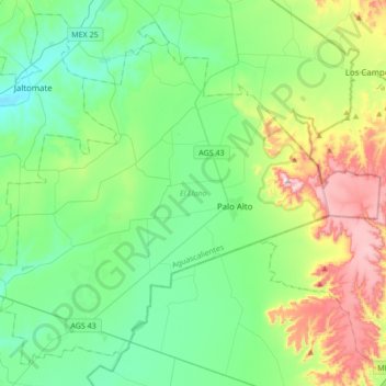
Name: El Llano topographic map, elevation, terrain.
Location: El Llano, Aguascalientes, Mexico (21.78785 -102.17604 22.06937 -101.83529)
Average elevation: 2,074 m
Minimum elevation: 1,918 m
Maximum elevation: 2,504 m
Thank you for supporting this site ❤️
Make a donation
Make a donation
Other topographic maps
Click on a map to view its topography, its elevation and its terrain.