
刘家峡镇 topographic map
Interactive map
Click on the map to display elevation.
About this map
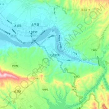
Name: 刘家峡镇 topographic map, elevation, terrain.
Location: 刘家峡镇, 永靖县, 临夏回族自治州, 甘肃省, 731600, 中国 (35.89894 103.26337 35.97894 103.34337)
Average elevation: 1,751 m
Minimum elevation: 1,615 m
Maximum elevation: 2,128 m
Other topographic maps
Click on a map to view its topography, its elevation and its terrain.