
诸由观镇 topographic map
Interactive map
Click on the map to display elevation.
About this map
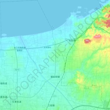
Name: 诸由观镇 topographic map, elevation, terrain.
Location: 诸由观镇, 龙口市, 烟台市, 山东省, 265700, 中国 (37.63657 120.47122 37.80300 120.67728)
Average elevation: 31 m
Minimum elevation: -4 m
Maximum elevation: 240 m
Other topographic maps
Click on a map to view its topography, its elevation and its terrain.