
Seal Rock topographic map
Interactive map
Click on the map to display elevation.
About this map
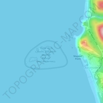
Name: Seal Rock topographic map, elevation, terrain.
Average elevation: 11 m
Minimum elevation: -5 m
Maximum elevation: 195 m
Other topographic maps
Click on a map to view its topography, its elevation and its terrain.
Oceanside
United States > Oregon > Tillamook County > Oceanside
Oceanside, Tillamook County, Oregon, 97134, United States
Average elevation: 61 m